- China’s Jilin-1 satellite constellation reportedly observing US military activity linked to strikes on Iranian targets.
- The network includes more than 300 commercial remote sensing satellites capable of high-frequency imaging.
- Analysts say such observations could allow China to study US operational patterns and logistics cycles.
- Satellite data could capture launch patterns, aircraft movement, and potential air defense activity.
- Growing commercial satellite constellations are reshaping intelligence collection in modern warfare.
China Jilin-1 Satellites Monitoring US War Operations
China’s Jilin-1 satellite constellation is reportedly observing US war operations connected to military strikes against Iranian targets, highlighting how commercial space assets are increasingly used to monitor modern conflict in near real time.
Defense analysts note that large satellite constellations can collect frequent imagery of military activity across wide areas. In this case, China’s Jilin-1 network, operated by Chang Guang Satellite Technology, has grown into one of the world’s largest commercial Earth observation systems.
With hundreds of satellites in orbit, the constellation can revisit locations multiple times per day, enabling analysts to track military movements, infrastructure activity, and operational patterns during an active conflict.
The development underscores how space based observation is becoming a major intelligence factor in contemporary warfare.
The Big Picture
Space based surveillance has become a central component of modern military intelligence. Both governments and commercial companies now operate large constellations capable of producing high resolution imagery with rapid revisit times.
China has invested heavily in expanding its Earth observation capabilities as part of its broader push to strengthen military space infrastructure and intelligence collection.
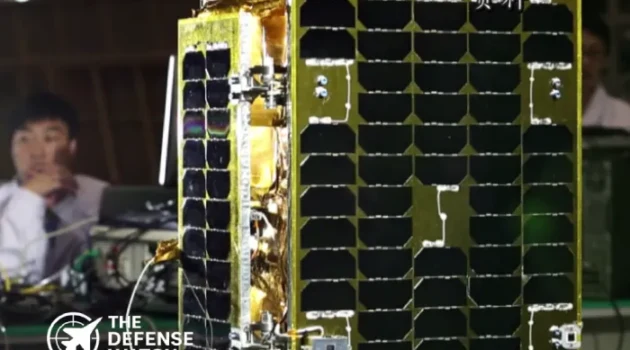
The Jilin-1 program reflects this effort. Developed by Chang Guang Satellite Technology, the constellation has steadily expanded since its first launch in 2015.
Chinese officials have previously stated that the program aims to deploy hundreds of satellites to provide near real time global imaging coverage.
Such capabilities allow analysts to monitor military bases, ports, airfields, missile launch sites, and troop movements across large regions.
What’s Happening
Reports circulating among defense analysts suggest that Jilin-1 satellites are collecting imagery of US military operations connected to strikes on Iranian facilities.
The constellation now includes more than 300 satellites capable of capturing optical imagery at relatively short intervals.
High frequency coverage allows analysts to observe operational indicators such as:
Aircraft movement at airbases
Fueling or logistical activity
Missile launch preparations
Damage assessments after strikes
Air defense deploymentsBecause satellite imagery can be captured repeatedly throughout the day, analysts can construct timelines of operational activity.
This form of intelligence analysis is commonly known as pattern of life observation.
Military planners often use such data to understand how forces operate during both routine and combat scenarios.
Why It Matters
Modern conflicts generate enormous amounts of observable data. Satellites can record aircraft launches, missile trajectories, runway activity, and movement of military vehicles.
When analyzed over time, these observations reveal operational patterns.
For example, analysts could identify how quickly aircraft are refueled between missions, how frequently airbases launch sorties, or how air defense units reposition after attacks.
Such insights help military planners understand an opponent’s operational doctrine.
Even when sensitive systems remain classified, external observation can still reveal useful information about how forces are deployed and sustained.
Large satellite constellations increase this capability by dramatically shortening the time between observations.
Strategic Implications
The growth of commercial satellite constellations is transforming the intelligence environment.
During past conflicts, governments controlled most high resolution imagery systems. Today, private companies operate many of the world’s most active Earth observation networks.
These systems can provide persistent monitoring of conflict zones.
For military planners, this means operational secrecy is becoming harder to maintain.
Even routine activities such as aircraft refueling, munitions loading, or base preparation can be captured in satellite imagery.
In a high intensity conflict, this data could reveal logistical capacity and operational tempo.
For China, access to large volumes of imagery could support long term military research and development.
Defense analysts often study real world operations to understand how modern forces conduct combat missions.
Such insights can influence training models, war games, and system development.
Competitor View
Chinese military analysts closely study US military operations to understand operational concepts used by American forces.
Observing real combat activity provides valuable data that cannot be fully replicated through simulations.
China has emphasized the importance of studying foreign military doctrine in several official defense publications.
Satellite imagery allows analysts to observe deployment patterns, base activity, and potential response timelines during crises.
Other nations also monitor conflicts using satellite data. Russia, European countries, and private intelligence firms regularly analyze imagery during major military operations.
This expanding intelligence ecosystem means that most modern conflicts are observed by multiple actors simultaneously.
Capability Gap
Persistent satellite observation highlights an operational challenge for modern militaries.
Traditional operational security measures focused on communications interception and espionage. Today, constant imaging from space adds another layer of exposure.
Military forces must assume that adversaries can observe large scale deployments or base activity.
To mitigate this risk, armed forces increasingly rely on deception techniques, dispersed basing, and rapid operational movement.
Even so, complete concealment is difficult when hundreds of satellites may pass over a region each day.
What To Watch Next
Several trends will shape how satellite intelligence affects future conflicts.
Satellite constellation expansion
Both China and the United States continue launching new observation satellites to improve coverage.Commercial intelligence markets
Private companies increasingly sell satellite imagery to governments and defense organizations.AI assisted imagery analysis
Artificial intelligence tools are being used to rapidly analyze large volumes of satellite data.These developments suggest that space based monitoring will play a growing role in global military competition.
The Bottom Line
Large satellite constellations such as China’s Jilin-1 are reshaping military intelligence by allowing near continuous observation of modern warfare from space.
Get real time update about this post category directly on your device, subscribe now.