Executive Summary
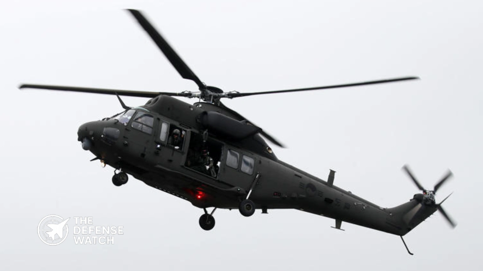
- A South Korean Army KUH-1 Surion helicopter from the 5th Corps crossed into the DMZ during a wildfire response on March 23, according to a Joint Chiefs of Staff inspection.
- The helicopter reportedly remained inside the DMZ for about seven minutes and later crossed the Military Demarcation Line, while the Army units responsible for tracking and controlling the aircraft did not identify the intrusion.
- The incident exposes a joint surveillance and command-and-control gap: the Army had a helicopter position tracking system, but the Air Force’s Central Air Defense Control Center reportedly became the organization that identified the aircraft’s abnormal position.
Army helicopter mistakenly enters DMZ, undetected by units
A South Korean Army KUH-1 Surion helicopter entered the Demilitarized Zone during a wildfire response in Yeoncheon, Gyeonggi Province, on March 23, and an ensuing military inspection found that multiple Army organizations failed to detect the unauthorized flight in real time. The helicopter was assigned to the Army’s 5th Corps but was operating in an area under the 1st Corps, creating an additional coordination challenge during the emergency mission.
The incident has since become a case study in the difference between having an aircraft tracking capability and actually using that capability as part of an effective command-and-control process. According to reporting based on the JCS inspection and information provided to National Assembly member Kang Sun-young’s office, the Army’s HAPS tracking system was available, but the relevant units did not properly monitor the helicopter’s position. The aircraft’s location was ultimately identified through the Air Force’s Central Air Defense Control Center, or MCRC.
How the DMZ Incursion Happened
The helicopter was dispatched to support wildfire suppression in the Yeoncheon area. According to the JCS inspection findings reported on September 21, the aircraft belonged to the 15th Aviation Group’s 201st Battalion under the 5th Corps, and two pilots were aboard. The mission was initially associated with firefighting support for the 5th Division.
The investigation found that the pilots were attempting to locate the assigned fire visually. After the original mission area had been extinguished, they identified another fire in the vicinity and moved toward it. The aircraft then entered an area of the DMZ associated with the neighboring 1st Corps.
The significance increased when the helicopter subsequently crossed the Military Demarcation Line. Earlier reporting in April had established that the helicopter had entered the DMZ, but the later JCS inspection concluded that it had crossed the MDL during the operation.
The available reporting does not establish that the aircraft intentionally entered either restricted area. The investigation instead attributed the event to an error in identifying the mission location and inadequate control by the supporting Army organizations.
Army Tracking System Did Not Prevent the Incursion
The most important technical issue is not the absence of tracking technology.
South Korean Army units reportedly had access to HAPS, a system intended to provide real-time information on Army helicopter positions. Yet the investigation found that the relevant organizations failed to properly monitor the aircraft’s location.
This distinction matters operationally. A position tracking system can provide coordinates, but it does not by itself guarantee that an aircraft crossing a restricted boundary will generate an effective warning, trigger an intervention, or reach the appropriate commander in time.
In this case, the reported chain was effectively reversed. Army organizations with direct responsibility for the aircraft did not identify the incursion, while the Air Force’s MCRC detected the helicopter through air-defense surveillance and notified the Army.
That makes the incident relevant beyond aviation safety. It raises questions about how Army aviation tracking, frontline corps control and Air Force air-defense surveillance are integrated during low-altitude operations near the inter-Korean border.
Reported Sequence of Events
| Stage | Reported development |
|---|---|
| March 23 | 5th Corps Surion helicopter dispatched for wildfire suppression |
| Mission area | Yeoncheon, within a frontline operating environment |
| Navigation error | Crew visually identified another fire after the assigned fire area was contained |
| DMZ entry | Helicopter entered the DMZ without the required authorization |
| MDL crossing | JCS inspection later concluded the aircraft crossed the Military Demarcation Line |
| Army response | Relevant Army units did not initially identify the violation |
| Detection | Air Force MCRC identified the aircraft through air-defense surveillance |
| Subsequent action | JCS inspection led to disciplinary measures against responsible organizations |
Why the Joint Surveillance Failure Matters
The Korean Peninsula presents an unusually sensitive environment for military aviation. The DMZ is approximately 4 kilometers wide, extending about 2 kilometers on either side of the Military Demarcation Line. Military aircraft operating in the southern portion of the DMZ require authorization from the United Nations Command under the established control procedures.
The April investigation initially focused on whether the helicopter had crossed the MDL. At that stage, the JCS said the aircraft had entered the DMZ and had flown near the MDL, while the military and UNC investigated the circumstances. The later inspection concluded that an actual MDL crossing had occurred.
That distinction is important because a DMZ entry and an MDL crossing represent different levels of sensitivity.
The reported seven-minute presence inside the DMZ also highlights the need for continuous monitoring rather than post-flight reconstruction. If a restricted boundary is treated as a geographic control line, an effective system needs to combine aircraft position data, geofencing or boundary alerts, command oversight and rapid communication between the aviation unit, supported formation and air-defense network.
Air Force Detection Exposed a Different Layer of the Defense Network
The Air Force’s role is one of the most significant elements of the incident.
The MCRC was conducting air-defense surveillance when it detected the Army helicopter and notified the relevant Army organizations. This indicates that the broader South Korean air-defense architecture was capable of seeing the aircraft even though the Army units responsible for the helicopter did not identify the violation themselves.
That does not mean the Air Force system was designed specifically to police every Army aviation navigation error. Air-defense surveillance has a different mission from tactical helicopter position management.
The problem exposed by the incident is therefore one of integration. A frontline force needs to know where its own aircraft are operating, particularly when those aircraft are close to a politically and militarily sensitive boundary. At the same time, national air-defense sensors provide an independent layer that can identify unusual aircraft movements.
The event suggests that these layers did not produce a sufficiently fast common operational picture during the mission.
Firefighting Missions Create a Different Risk Profile
The incident also demonstrates why emergency military support missions require different control measures from planned combat or training sorties.
A firefighting helicopter may be required to respond quickly to changing fire locations. Visual identification of smoke or flames can cause crews to adjust their route, especially in mountainous terrain where visibility, wind and terrain can complicate navigation.
That flexibility becomes more difficult near the DMZ. An aircraft can move only a short distance before crossing a boundary that carries military and political consequences.
The appropriate technical lesson is therefore not simply that pilots should avoid navigation errors. It is that mission management systems need to make restricted boundaries difficult to cross unintentionally.
For military aviation, this can include continuously updated digital maps, clearly displayed restricted areas, route validation, automated boundary warnings and direct coordination between the aircraft and the controlling units. The precise systems and procedures used by the South Korean military in this case have not been publicly detailed, so specific technical shortcomings beyond those identified by the JCS should not be assumed.
Disciplinary Measures Point to a Command-and-Control Problem
The JCS inspection reportedly required institutional disciplinary action after finding that the involved Army units failed to identify the DMZ violation.
According to reporting based on information supplied to Kang’s office, the 1st and 5th Corps received warning-level disciplinary measures in July. The Army Ground Operations Command received a caution-level measure, while the Army Aviation Command received a notification-level measure earlier in September.
These measures are significant because responsibility was not attributed solely to the flight crew.
The reported findings point toward multiple layers of responsibility: the helicopter crew’s navigation decision, the supported area’s identification of the aircraft, the aircraft’s parent formation, higher-level ground operations control and Army aviation oversight.
That is consistent with the central operational issue. A military aviation safety system should contain several opportunities to detect and correct an aircraft that is approaching or entering a prohibited area.
Implications for South Korean Airspace Security
The incident does not demonstrate that South Korea lacks the sensors required to monitor low-altitude military aircraft. The Air Force’s detection of the helicopter demonstrates the opposite.
The more relevant concern is whether information from separate systems reaches the right operator quickly enough to prevent an incident.
For a frontline force facing North Korea, this distinction is important. The South Korean military must simultaneously manage routine Army aviation, emergency missions such as wildfire suppression, air-defense surveillance and the special access restrictions associated with the DMZ.
The March incident shows that these functions can become disconnected even when the underlying sensors and tracking systems exist.
A stronger architecture would ideally provide commanders with a common view of friendly aircraft, restricted boundaries and airspace status, with automatic alerts when an aircraft approaches a prohibited area. It would also reduce reliance on individual operators manually checking aircraft positions during fast-moving missions.
There is no public evidence establishing that such a redesign has already been implemented as a direct result of this incident. Any claims about specific new systems, software changes or future procurement should therefore be treated as unconfirmed unless released by South Korean defense authorities.
North Korean Response Was Limited
The incident occurred in one of the world’s most heavily monitored military border environments, but available reporting indicates that North Korean forces did not show an unusual response at the time.
The helicopter was also reported to have been unarmed during the mission. Earlier JCS reporting said the military was investigating the circumstances and did not provide additional operational details.
The absence of a reported North Korean response does not eliminate the operational risk. An unidentified or unexpectedly positioned South Korean military aircraft near the MDL could create uncertainty for opposing forces, particularly if the aircraft’s intent cannot be immediately established.
For that reason, the primary lesson is not about the aircraft’s combat capability. It is about preventing an avoidable airspace-control event from becoming a larger military incident.
What the Incident Says About South Korea’s Joint Force
South Korea has invested heavily in integrated air surveillance, command networks and modern military aviation. The incident illustrates a less visible challenge: integration depends not only on equipment, but also on procedures, operator attention and clearly assigned responsibility.
Three layers are particularly relevant:
- Aircraft level: The crew must maintain accurate awareness of its authorized operating area.
- Army command level: The parent unit and responsible corps must continuously track friendly aircraft and recognize boundary violations.
- Joint air-defense level: The Air Force must maintain an independent surveillance picture capable of identifying abnormal or unidentified aircraft.
The March incident shows that the third layer detected a problem that the first two layers had failed to recognize in time.
That makes the episode relevant to broader South Korean efforts to strengthen joint-domain awareness. Modern military networks are valuable only when sensor data becomes actionable information for commanders and operators.
Strategic Assessment
The incident is best understood as a command-and-control and airspace-management failure rather than a failure of helicopter technology.
The Surion was performing a legitimate emergency support mission. The immediate error involved the aircraft’s location and mission area, but the larger vulnerability emerged because multiple organizations did not detect the aircraft’s movement into restricted airspace.
The case also demonstrates why frontline military forces need redundant monitoring. A single tracking system can provide location data, but independent surveillance from another service can provide a critical safety layer.
For South Korea, the priority is therefore likely to be ensuring that aircraft tracking, geospatial boundary controls and joint air-defense surveillance remain connected during both routine and emergency missions. The precise corrective measures remain subject to official disclosure.
The incident ultimately reinforces a basic principle of modern air operations: knowing where a friendly aircraft is located is only the first step. The command system must also know whether that position is authorized and must be able to intervene before a navigation error becomes a security incident.