• Home
  • About
  • Defense Systems
  • Manufacturer
  • Comparisons
  • Compare 
  • Tools
TheDefenseWatch.com
  • Aerospace & Aviation
  • Military & Ordnance
  • Naval & Maritime
  • Cyber & Space Defense
  • Policy & Strategy
  • Global News
  • Tools Library
    • Smart Calculator
    • Drone Flight Time Calculator
    • Drone Range Calculator
    • Counter-Drone Jammer Effective Range Calculator
    • Counter-Battery Radar Detection Calculator
    • Artillery Fire Correction Calculator
    • Thermal Camera Detection Range Calculator
    • Missile Range & Time-of-Flight Calculator
    • Radar Detection Range Calculator
    • FPV Strike Drone Payload vs Range Calculator
    • Loitering Munition Endurance Calculator
    • Sniper Ballistic Drop & Windage Calculator
    • Bullet Drop Calculator
    • U.S. Army Combat Fitness Test (ACFT) Calculator
    • Military Pension Calculator
    • Military Retirement Calculator
    • Military Pension Calculator
    • Large Number Calculator
Font ResizerAa

TheDefenseWatch.com

The Defense Watch | U.S. & Global Defense News, Analysis & Military Updates

Search
  • Home
  • About
  • Defense Systems
  • Manufacturer
  • Comparisons
  • Compare 
  • Tools

Stay Updated

Get the latest update

Subscribe

Explore

  • Drone
  • Fighter Jets & Military Aircraft
  • Hypersonic Weapons
  • Aircraft Carriers
  • Strategic History & Missions
  • Tools Library
Home » Iran Expands Targeting Capability With Chinese Spy Satellite Across Middle East Bases
Cyber & Space DefenseSpace Assets & Satellites

Iran Expands Targeting Capability With Chinese Spy Satellite Across Middle East Bases

Kaleem Sheikh | Regional Defense Correspondent
Last updated: September 12, 2026 6:50 pm
Kaleem Sheikh | Regional Defense Correspondent
Share
6 Min Read
Iran Chinese spy satellite targeting
SHARE

Iran Chinese Spy Satellite Targeting US Bases Signals ISR Shift

Iran Chinese spy satellite targeting of U.S. military installations in the Middle East marks a notable evolution in Tehran’s intelligence, surveillance, and reconnaissance capabilities, according to a report by the Financial Times. The report cites leaked documents indicating that Iran used a Chinese-provided satellite system to monitor and potentially support strike operations against American and allied positions across the region.

Contents
  • Iran Chinese Spy Satellite Targeting US Bases Signals ISR Shift
  • Satellite Acquisition And Operational Use
  • Precision Gains Over Previous Systems
  • Integration Into Strike Operations
  • Role Of Chinese Commercial Providers
  • Strategic And Operational Implications

The development underscores a growing integration of commercial and foreign-supplied space-based assets into Iran’s military planning cycle, narrowing long-standing gaps in precision targeting and real-time battlefield awareness.

¦ KEY FACTS AT A GLANCE
  • Iran reportedly acquired the Chinese-built “TEE-01B” reconnaissance satellite in late 2024.
  • The satellite provided imagery of multiple U.S. and allied bases across the Middle East.
  • High-resolution imagery, estimated at around 0.5 meters, enabled improved target identification.
  • Satellite data was reportedly used before and after drone and missile strikes in March.
  • China denied involvement, rejecting claims tied to military targeting operations.

Satellite Acquisition And Operational Use

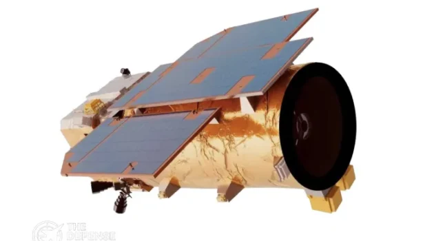
According to the report, Iran obtained control of the Chinese-built “TEE-01B” satellite in late 2024, after it was launched from China and transferred to Iranian operators. The system is believed to be operated by the Islamic Revolutionary Guard Corps Aerospace Force.

  • TEE-01B Satellite (China)

    TEE-01B Satellite (China)

    • Imaging / Detection Capability: Panchromatic/multispectral optical remote sensing; ~0.52 m panchromatic and ~2.1 m multispectral ground resolution; swath width >14.8 km.
    • Frequency Band / Communication: Not publicly detailed; typical X-band or Ka-band downlink for high-resolution Earth observation data.
    • Sensor / Antenna Type: Optical telescope with panchromatic and multispectral imager.
    • Coverage / Target Tracking Capacity: egional coverage with LEO passes; suitable for fixed-site monitoring and change detection rather than continuous tracking.
    • View Details →
    6.3

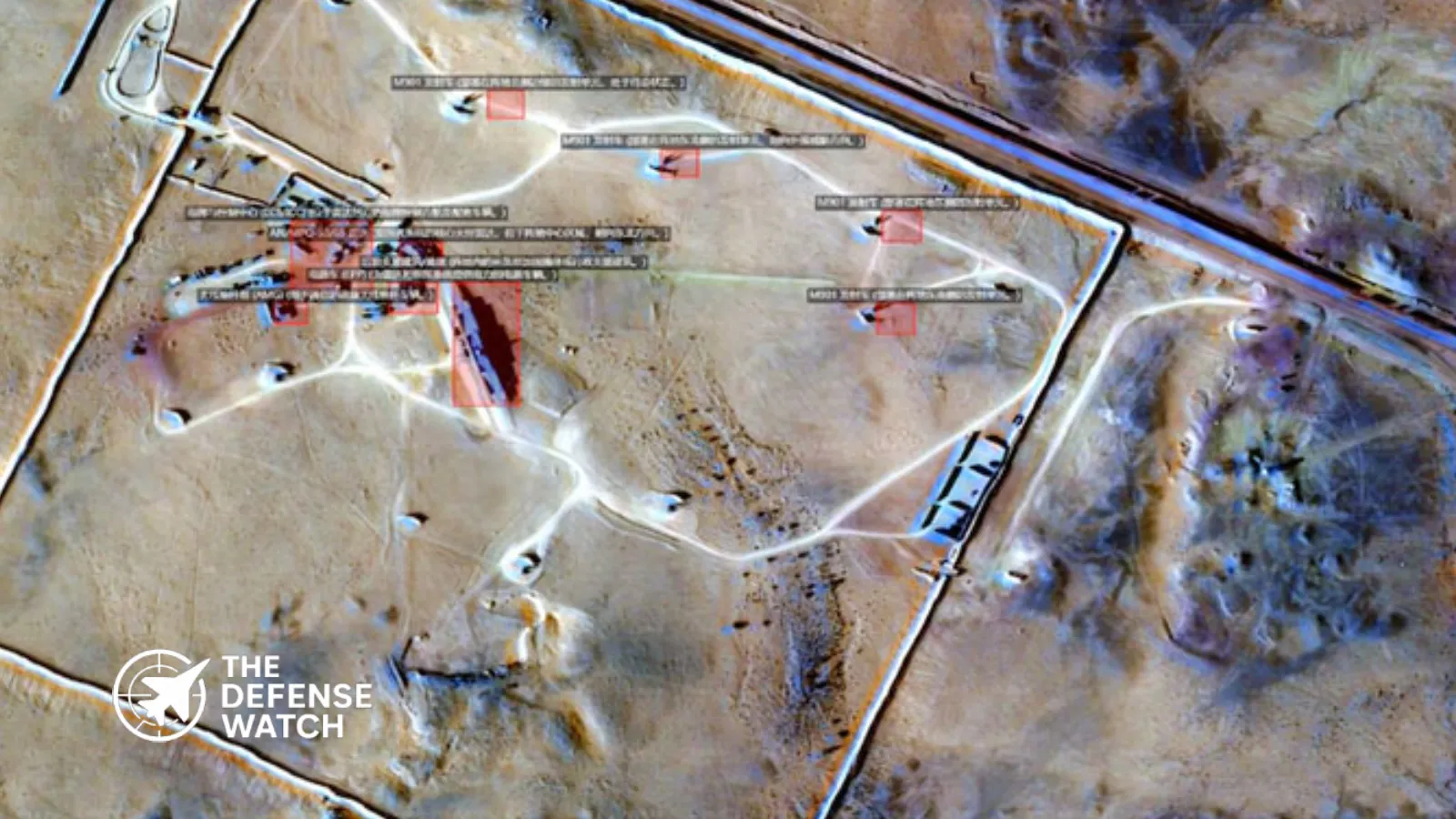
    The satellite reportedly captured imagery of key U.S. and allied military installations, including air bases, logistics hubs, and naval facilities. Among the locations monitored were Prince Sultan Air Base in Saudi Arabia, Muwaffaq al-Salti Air Base in Jordan, and sites near the U.S. Fifth Fleet headquarters in Bahrain.

    Additional surveillance targets included Erbil Air Base in Iraq, Ali Al Salem Air Base in Kuwait, Camp Lemonnier in Djibouti, and Duqm Airfield in Oman. Civilian infrastructure, including ports and energy facilities in the Gulf, was also reportedly observed.

    Imagery collection dates cited in the report align with mid-March activity, when Iranian-linked strikes targeted some of these locations.

    Precision Gains Over Previous Systems

    A key aspect of Iran Chinese spy satellite targeting capability lies in the system’s improved resolution. The TEE-01B satellite reportedly offers imagery resolution of approximately 0.5 meters, a significant upgrade over Iran’s domestically developed Noor-3 satellite, which is estimated at around 5 meters.

    This level of detail enables identification of individual aircraft, support equipment, and infrastructure layouts. In operational terms, such precision can support strike planning, battle damage assessment, and pattern-of-life analysis.

    From a military standpoint, this represents a shift from broad surveillance to actionable intelligence. It allows Iran to refine targeting cycles, reduce uncertainty, and potentially increase the effectiveness of drone and missile operations.

    Integration Into Strike Operations

    The report indicates that satellite imagery was collected both before and after attacks, suggesting integration into Iran’s targeting workflow. Pre-strike imagery likely supported target validation and planning, while post-strike imagery enabled damage assessment.

    • TEE-01B Satellite (China)

      TEE-01B Satellite (China)

      • Imaging / Detection Capability: Panchromatic/multispectral optical remote sensing; ~0.52 m panchromatic and ~2.1 m multispectral ground resolution; swath width >14.8 km.
      • Frequency Band / Communication: Not publicly detailed; typical X-band or Ka-band downlink for high-resolution Earth observation data.
      • Sensor / Antenna Type: Optical telescope with panchromatic and multispectral imager.
      • Coverage / Target Tracking Capacity: egional coverage with LEO passes; suitable for fixed-site monitoring and change detection rather than continuous tracking.
      • View Details →
      6.3

      This mirrors operational practices used by advanced militaries, where ISR assets are tightly linked to strike platforms in a continuous feedback loop.

      For Iran, which has relied heavily on drones and ballistic missiles, improved ISR could enhance the accuracy and timing of such systems. It also reduces reliance on human intelligence or less reliable reconnaissance methods.

      Role Of Chinese Commercial Providers

      The satellite and its supporting ground infrastructure were reportedly supplied by Chinese companies Earth Eye Co and Emposat. The deal, valued at approximately $36.6 million, included satellite access, launch services, and data infrastructure.

      While such arrangements are often framed as commercial, dual-use capabilities are inherent in high-resolution Earth observation systems. The same imagery used for civilian purposes can support military operations when integrated into targeting networks.

      China has denied the allegations, stating that it opposes the spread of unverified information and supports peaceful uses of space technology.

      Strategic And Operational Implications

      Iran Chinese spy satellite targeting highlights a broader trend in modern warfare, where access to space-based ISR is no longer limited to major powers. Commercial satellites and international partnerships are enabling regional actors to close capability gaps.

      • TEE-01B Satellite (China)

        TEE-01B Satellite (China)

        • Imaging / Detection Capability: Panchromatic/multispectral optical remote sensing; ~0.52 m panchromatic and ~2.1 m multispectral ground resolution; swath width >14.8 km.
        • Frequency Band / Communication: Not publicly detailed; typical X-band or Ka-band downlink for high-resolution Earth observation data.
        • Sensor / Antenna Type: Optical telescope with panchromatic and multispectral imager.
        • Coverage / Target Tracking Capacity: egional coverage with LEO passes; suitable for fixed-site monitoring and change detection rather than continuous tracking.
        • View Details →
        6.3

        For U.S. forces and allies in the Middle East, this development introduces new operational risks. Fixed installations, previously shielded by distance or limited adversary ISR, are now more exposed to persistent surveillance.

        This could drive changes in force posture, including increased mobility, deception measures, and hardened infrastructure.

        From a strategic perspective, the integration of foreign satellite capabilities into Iran’s military ecosystem reflects deepening technological ties and a shift toward more networked warfare concepts.
TAGGED:China satelliteFeaturedIran militaryISR systemsspace intelligenceUS bases Middle East
Share This Article
Facebook Copy Link Print
ByKaleem Sheikh | Regional Defense Correspondent
Follow:
Kaleem Sheikh is a regional defense correspondent at TheDefenseWatch.com covering defense and security developments across Asia and the Middle East, including military operations, procurement, and regional security issues.
Leave a Comment

Leave a Reply Cancel reply

Your email address will not be published. Required fields are marked *

Latest Defense Systems

  • Tomahawk Block V Missile Tomahawk Block V Missile
  • Tomahawk Block IV Missile Tomahawk Block IV Missile
  • SU-57 Felon Stealth Fighter SU-57 Felon Stealth Fighter
  • Boeing F/A-XX Fighter Boeing F/A-XX Fighter
  • JF-17 Thunder Fighter Jet JF-17 Thunder Fighter Jet
  • Gaurav Glide Bomb Gaurav Glide Bomb
  • F-47 Fighter Jet F-47 Fighter Jet
  • Spirit UAS Spirit UAS
  • GBU-43/B MOAB Bomb GBU-43/B MOAB Bomb

Recent Compares

  • J-10C vs JF-17 Thunder: Which Fighter Is More Capable? J-10C vs JF-17 Thunder: Which Fighter Is More Capable? View Comparison →
  • Tejas vs Gripen: Key Differences and Capabilities Tejas vs Gripen: Key Differences and Capabilities View Comparison →
  • Tejas vs MiG-21 Bison: How India Replaced Its Iconic Supersonic Fighter Tejas vs MiG-21 Bison: How India Replaced Its Iconic Supersonic Fighter View Comparison →
  • F-35 vs F-16: Stealth, Sensors and Combat Roles F-35 vs F-16: Stealth, Sensors and Combat Roles View Comparison →
  • Tejas Fighter Jet vs F-16 Fighting Falcon: Capability Compared Tejas Fighter Jet vs F-16 Fighting Falcon: Capability Compared View Comparison →
  • Rafale Fighter Jet vs F-16 Fighting Falcon : Which Fighter Has the Edge? Rafale Fighter Jet vs F-16 Fighting Falcon : Which Fighter Has the Edge? View Comparison →
  • Su-57 Fighter Jet vs J-20 Fighter Jet: Stealth and Air Combat Compared Su-57 Fighter Jet vs J-20 Fighter Jet: Stealth and Air Combat Compared View Comparison →
  • Mirage 2000 vs Tejas Mk1A: Legacy Combat Power vs Indigenous Modernization Mirage 2000 vs Tejas Mk1A: Legacy Combat Power vs Indigenous Modernization View Comparison →
  • Rafale Fighter Jet vs F-22 Raptor: Which Air Dominance Fighter Has the Edge? Rafale Fighter Jet vs F-22 Raptor: Which Air Dominance Fighter Has the Edge? View Comparison →
  • Tejas Fighter Jet vs. Rafale Fighter Jet: India’s Indigenous Fighter Meets France’s Proven Multirole Combat Aircraft Tejas Fighter Jet vs. Rafale Fighter Jet: India’s Indigenous Fighter Meets France’s Proven Multirole Combat Aircraft View Comparison →

Recent Posts

  • P-800 Oniks Missile: Range, Speed and BrahMos Comparison
  • Ukrainian Drone Unit Caused 70% of Simulated U.S. Brigade Casualties in Germany Exercise
  • OCCAR Marks 25 Years of European Defense Cooperation With 28 Programs
  • Saab Q3 2026 Results Show 30.6% Organic Sales Growth as Orders Surge
  • How Much Does a Tomahawk Missile Cost? Price, Range and Blocks

You Might Also Like

Army lasers blast drones
Cyber & Space Defense

Army Lasers Blast Drones, Proving Directed Energy Weapons Are Reshaping Counter UAS Warfare

September 7, 2026
Israeli fighter jets Iran airspace routes
Middle East Defense & Security

Israeli Fighter Jets and the Iran Air Corridor: Route Analysis and Strategic Implications

September 7, 2026
U.S. Space Force Andromeda program
Cyber & Space DefenseSpace Assets & Satellites

U.S. Space Force Awards Contracts To Expand Orbital Surveillance Under Andromeda Program

April 12, 2026
THAAD
Cyber & Space Defense

THAAD’s Role in U.S. Air Defence: How the Terminal High Altitude Area Defense System Fits into America’s Missile Shield

September 8, 2026

Logo

Copyright © 2026 TheDefenseWatch.com

Helpful Links

  • Home
  • About Us
  • Privacy Policy
  • Terms of Use / Disclaimer
  • U.S. Privacy Notice – CCPA Compliance

Defense Systems

  • Defense Systems
  • Comparisons 
  • Manufacturer
  • Tactical Calculators

Popuplar

Which 5 Air Forces Possess the Costliest Fighter Jet Fleets in the World
Evolving Strategic Value: Carrier Strike Groups in the Indo-Pacific’s Future Security Architecture
Autonomous Weapon Systems Spark U.S. Ethics Debate Amid Rapid Military AI Integration

We report on developments involving military forces, governments, defense companies, research organizations, and security institutions around the world. 

Welcome Back!

Sign in to your account

Username or Email Address
Password

Lost your password?