

Iran Chinese Spy Satellite Targeting US Bases Signals ISR Shift
Iran Chinese spy satellite targeting of U.S. military installations in the Middle East marks a notable evolution in Tehran’s intelligence, surveillance, and reconnaissance capabilities, according to a report by the Financial Times. The report cites leaked documents indicating that Iran used a Chinese-provided satellite system to monitor and potentially support strike operations against American and allied positions across the region.
The development underscores a growing integration of commercial and foreign-supplied space-based assets into Iran’s military planning cycle, narrowing long-standing gaps in precision targeting and real-time battlefield awareness.
- Iran reportedly acquired the Chinese-built “TEE-01B” reconnaissance satellite in late 2024.
- The satellite provided imagery of multiple U.S. and allied bases across the Middle East.
- High-resolution imagery, estimated at around 0.5 meters, enabled improved target identification.
- Satellite data was reportedly used before and after drone and missile strikes in March.
- China denied involvement, rejecting claims tied to military targeting operations.
Satellite Acquisition And Operational Use
According to the report, Iran obtained control of the Chinese-built “TEE-01B” satellite in late 2024, after it was launched from China and transferred to Iranian operators. The system is believed to be operated by the Islamic Revolutionary Guard Corps Aerospace Force.
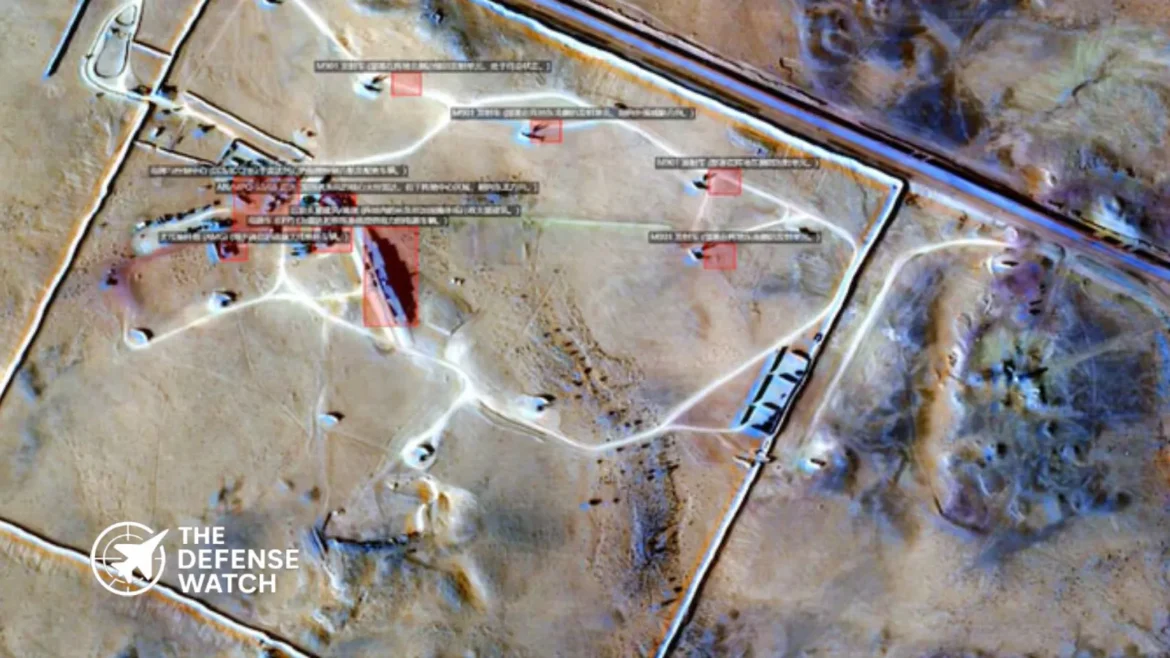
The satellite reportedly captured imagery of key U.S. and allied military installations, including air bases, logistics hubs, and naval facilities. Among the locations monitored were Prince Sultan Air Base in Saudi Arabia, Muwaffaq al-Salti Air Base in Jordan, and sites near the U.S. Fifth Fleet headquarters in Bahrain.
Additional surveillance targets included Erbil Air Base in Iraq, Ali Al Salem Air Base in Kuwait, Camp Lemonnier in Djibouti, and Duqm Airfield in Oman. Civilian infrastructure, including ports and energy facilities in the Gulf, was also reportedly observed.
Imagery collection dates cited in the report align with mid-March activity, when Iranian-linked strikes targeted some of these locations.
Precision Gains Over Previous Systems
A key aspect of Iran Chinese spy satellite targeting capability lies in the system’s improved resolution. The TEE-01B satellite reportedly offers imagery resolution of approximately 0.5 meters, a significant upgrade over Iran’s domestically developed Noor-3 satellite, which is estimated at around 5 meters.
This level of detail enables identification of individual aircraft, support equipment, and infrastructure layouts. In operational terms, such precision can support strike planning, battle damage assessment, and pattern-of-life analysis.
From a military standpoint, this represents a shift from broad surveillance to actionable intelligence. It allows Iran to refine targeting cycles, reduce uncertainty, and potentially increase the effectiveness of drone and missile operations.
Integration Into Strike Operations
The report indicates that satellite imagery was collected both before and after attacks, suggesting integration into Iran’s targeting workflow. Pre-strike imagery likely supported target validation and planning, while post-strike imagery enabled damage assessment.
This mirrors operational practices used by advanced militaries, where ISR assets are tightly linked to strike platforms in a continuous feedback loop.
For Iran, which has relied heavily on drones and ballistic missiles, improved ISR could enhance the accuracy and timing of such systems. It also reduces reliance on human intelligence or less reliable reconnaissance methods.
Role Of Chinese Commercial Providers
The satellite and its supporting ground infrastructure were reportedly supplied by Chinese companies Earth Eye Co and Emposat. The deal, valued at approximately $36.6 million, included satellite access, launch services, and data infrastructure.
While such arrangements are often framed as commercial, dual-use capabilities are inherent in high-resolution Earth observation systems. The same imagery used for civilian purposes can support military operations when integrated into targeting networks.
China has denied the allegations, stating that it opposes the spread of unverified information and supports peaceful uses of space technology.
Strategic And Operational Implications
Iran Chinese spy satellite targeting highlights a broader trend in modern warfare, where access to space-based ISR is no longer limited to major powers. Commercial satellites and international partnerships are enabling regional actors to close capability gaps.
For U.S. forces and allies in the Middle East, this development introduces new operational risks. Fixed installations, previously shielded by distance or limited adversary ISR, are now more exposed to persistent surveillance.
This could drive changes in force posture, including increased mobility, deception measures, and hardened infrastructure.
From a strategic perspective, the integration of foreign satellite capabilities into Iran’s military ecosystem reflects deepening technological ties and a shift toward more networked warfare concepts.
BlackSky Secures Multiple Gen-3 Expansion Contracts
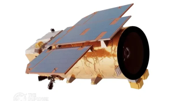
BlackSky Technology Inc. has finalized several Gen-3 expansion contracts, transitioning early access pilot programs into full renewal agreements with customers across the Americas, Europe, and Asia. The deals support the company’s land-and-expand strategy and reflect growing global investment in tactical, commercial space-based intelligence.
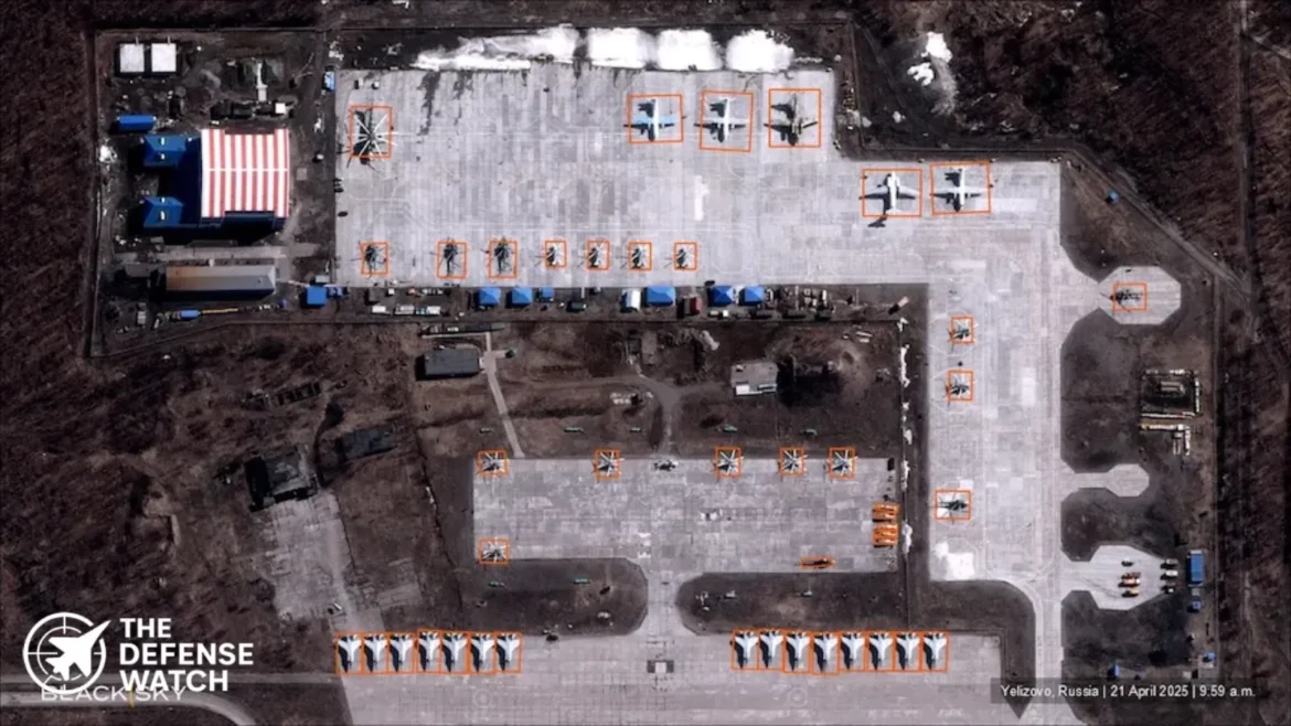
The Gen-3 services provide high-cadence, low-latency satellite imagery and AI-enabled analytics to support time-sensitive intelligence, surveillance, and reconnaissance operations. These capabilities are increasingly integrated directly into secure national workflows for defense applications.
Brian O’Toole, CEO of BlackSky, said, “BlackSky’s reliable high-cadence, low-latency Gen-3 monitoring services continue to gain global traction, accelerating our most demanding customers’ ability to attain rapid insight during time-critical operations.”
AI-Enabled Real-Time Intelligence
BlackSky’s Gen-3 system offers autonomous detection and classification of tactical targets such as vessels and aircraft, while maintaining continuous monitoring across borders and maritime zones. This reduces dependence on limited intelligence assets from other nations.
O’Toole noted that guaranteed time-sensitive imagery and analytics are now a primary driver of defense spending, as nations increasingly require real-time decision advantages in their security operations. BlackSky’s assured services provide priority tasking and enhanced image clarity to support actionable intelligence.
Vertically Integrated Technology Stack
The company’s approach integrates satellite manufacturing, AI software, and proprietary low Earth orbit constellations to deliver both On-Demand and Assured services. This vertical integration allows for rapid deployment of space-based intelligence solutions, giving military and government clients access to timely, actionable data.
By leveraging fully sovereign systems or commercial satellites, BlackSky provides flexible, responsive capabilities that meet the operational needs of international defense customers.
Global Defense Market Implications
These new contracts underscore the rising demand for tactical space-based intelligence. Analysts suggest that AI-forward satellite services like BlackSky’s Gen-3 are becoming critical for countries seeking faster, more reliable situational awareness amid evolving geopolitical tensions.
The expansion of Gen-3 services illustrates the shift toward integrating commercial space assets into national defense frameworks, a trend expected to grow as nations prioritize real-time ISR capabilities.