
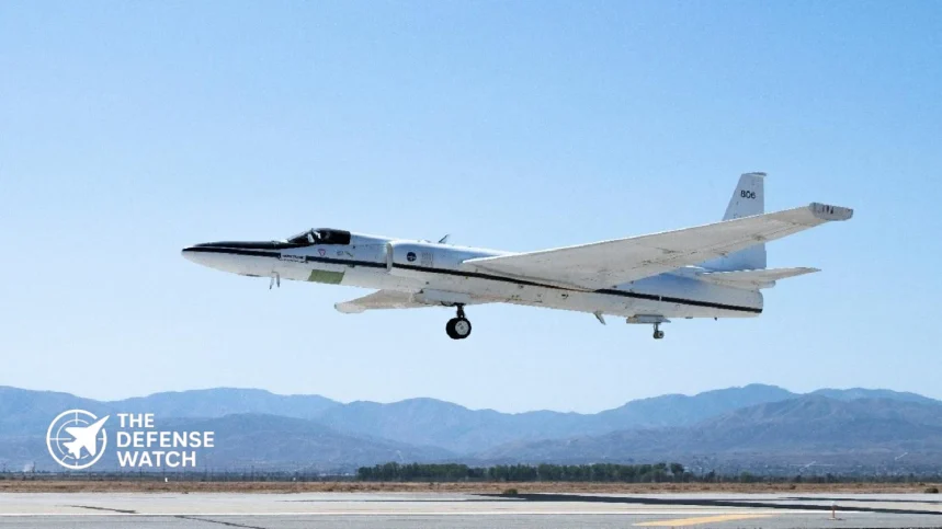
The U.S. Naval Research Laboratory (NRL) has completed its first field campaign under the Injected Smoke and PYRocumulonimbus Experiment (INSPYRE), a NASA-funded research effort examining how intense wildfires generate powerful storms and transport smoke into the upper atmosphere.
The 2026 campaign collected airborne and ground-based measurements across the western United States and Canada. Researchers also tracked a smoke plume originating from Siberian wildfires as it moved across the Arctic and North Pacific, providing an opportunity to study how smoke changes during long-distance atmospheric transport.
The research has implications beyond wildfire forecasting. Atmospheric smoke and airborne particles can affect military aviation, satellite communications, laser systems and electro-optical equipment used for surveillance and targeting.
According to the U.S. Department of War announcement published November 17, the campaign has moved into its data-processing and scientific analysis phase, with researchers preparing for another deployment in 2027.
Inside the INSPYRE Research Mission
INSPYRE is designed to investigate pyrocumulonimbus storms, commonly called pyroCbs. These are powerful thunderstorm-like systems generated by intense wildfires.
Unlike conventional thunderstorms, pyroCbs develop from the heat and atmospheric instability produced by large fires. Their strong updrafts can carry smoke, ash and other particles to high altitudes, sometimes reaching the stratosphere.
These events create several forecasting challenges. Researchers need to understand which fires are likely to generate pyroCbs, how much smoke they inject into the atmosphere and how the resulting plumes evolve over time.
NASA describes these questions as central objectives of the INSPYRE mission, which combines aircraft observations, ground-based instruments, satellite measurements and atmospheric modeling.
The research is particularly relevant because satellite imagery alone cannot provide a complete picture of smoke composition and particle behavior. Direct measurements help scientists determine particle size, chemical properties and how smoke absorbs or reflects solar radiation.
These characteristics influence atmospheric heating, visibility and the movement of smoke through different layers of the atmosphere.
Two Research Aircraft Provided Different Perspectives
The campaign relied on two specialized aircraft, each performing a different scientific role.
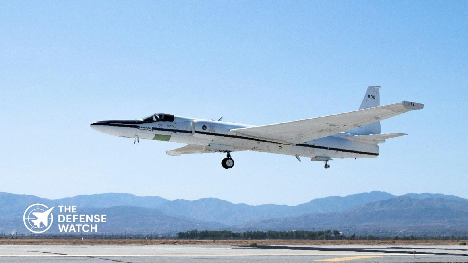
NASA ER-2
NASA’s ER-2 operated above active weather systems, carrying scientific instruments designed to observe wildfire intensity, cloud development, lightning-related activity and smoke distribution.
One important instrument was the In-situ Spectrometer for Terrestrial Lightning Observations (iSTORM), developed by NRL’s Space Science Division.
The instrument measured terrestrial gamma-ray flashes associated with lightning activity inside fire-generated storms. Such observations can help researchers investigate electrical processes within pyroCbs and improve understanding of their behavior.
NSF/NCAR Gulfstream V
The National Science Foundation and National Center for Atmospheric Research (NSF/NCAR) Gulfstream V served a different purpose.
Rather than observing storms primarily from above, the aircraft collected measurements directly inside smoke plumes and fire-generated clouds.
The aircraft carried equipment for sampling smoke particles, atmospheric gases and other properties that cannot be fully characterized through remote observations.
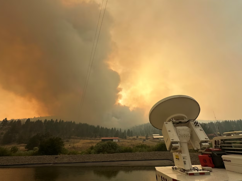
A ground-based atmospheric research instrument is positioned near a wildfire as a towering smoke plume rises above the surrounding landscape during the 2026 Injected Smoke and Pyrocumulonimbus Experiment field campaign.
NRL reported that both aircraft accumulated more than 100 flight hours during the campaign. They investigated wildfire activity from Arizona to Canada and followed transported smoke as far as Alaska. Ground teams also deployed mobile radar and lidar equipment near active fires.
Tracking Smoke From Siberia Across the Pacific
One of the campaign’s important research opportunities involved a smoke plume originating from wildfires in Siberia.
The smoke traveled across the Arctic, over Alaska and toward the North Pacific before researchers intercepted it during three consecutive days of airborne observations.
Both research aircraft observed the plume, with some flights coordinated around satellite overpasses.
The ER-2 also descended to approximately 38,000 feet to support direct plume sampling alongside the Gulfstream V. This allowed scientists to compare measurements collected inside the smoke with observations from above.
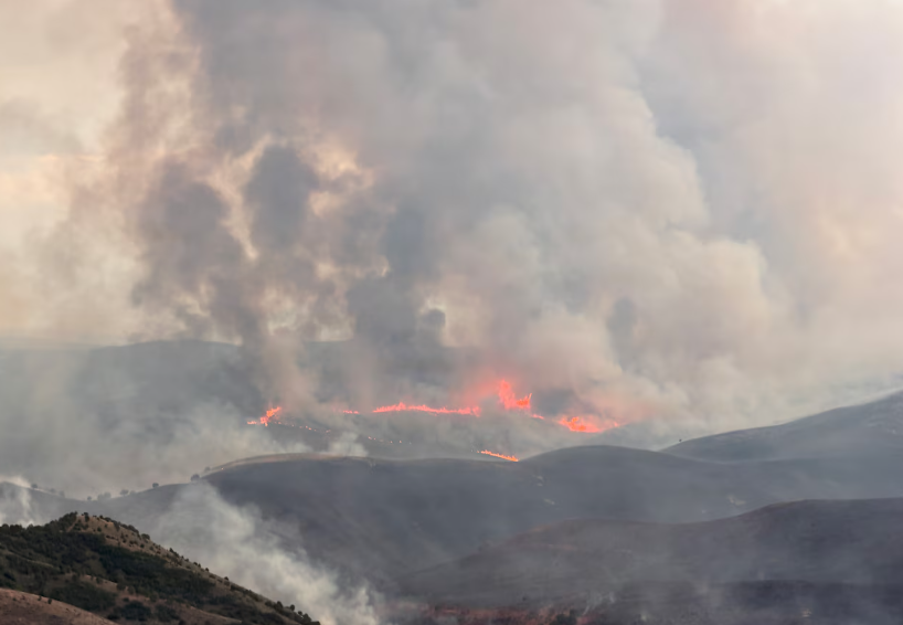
The combination of aircraft and satellite data provides a way to examine how smoke evolves during long-distance transport, rather than studying only the conditions immediately surrounding a wildfire.
This is important because the characteristics of a plume can change as particles interact with atmospheric conditions. Better measurements should help researchers reduce uncertainties in models that predict smoke movement, altitude and atmospheric effects.
Why the Research Matters to the U.S. Military
Although INSPYRE is primarily an atmospheric science mission, its findings could support several defense-related activities.
Smoke is not simply a visibility problem. Suspended particles can interfere with the transmission of electromagnetic energy and affect the performance of optical equipment.
NRL research meteorologist David Peterson identified several military applications, including:
- Laser systems: Smoke and dust particles can scatter or absorb laser energy, reducing the effectiveness of systems that depend on optical transmission.
- Satellite communications: Atmospheric conditions and aerosol properties can affect certain optical communication links.
- Targeting cameras: Smoke can reduce visibility and degrade electro-optical observation.
- Military aviation: Smoke layers and fire-generated weather can complicate flight planning and create hazardous conditions for aircraft operating near affected areas.
These effects are particularly relevant to operations that depend on accurate environmental information.
For example, a military unit planning to use an airborne optical sensor or laser-based system needs to understand more than whether smoke is present. Its altitude, density, particle characteristics and movement can also affect system performance.
The INSPYRE measurements could eventually improve the environmental information available to planners. However, the campaign has not demonstrated a new operational military capability or established that existing forecasting systems have already been upgraded.
An Unusual Observation at the Utah Wildfire
The campaign also identified atmospheric behavior that researchers had not fully anticipated.
At Utah’s Widemouth 2 fire, scientists observed a fire-driven cloud transporting smoke to approximately 36,000 feet, even though the cloud did not meet the team’s working definition of a pyrocumulonimbus.
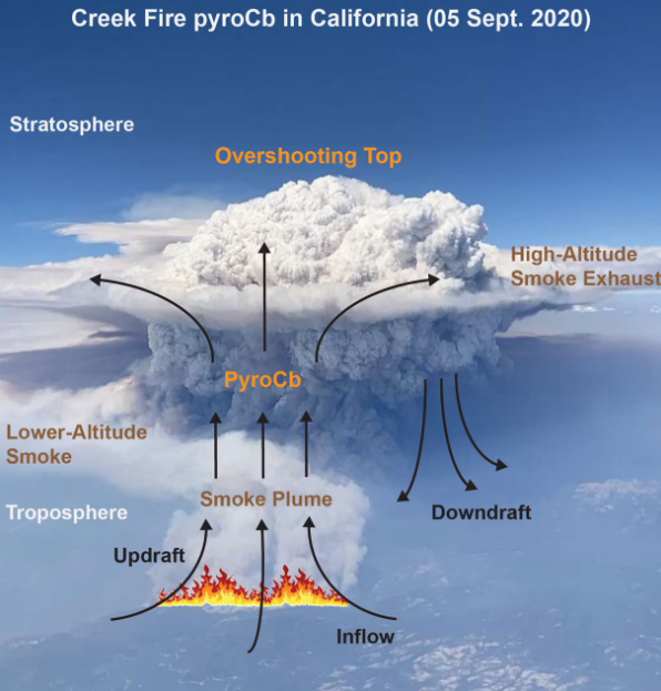
The observation raises an important research question: Can fire-generated clouds that do not meet the formal pyroCb classification still inject substantial quantities of smoke into the upper atmosphere?
That distinction matters for forecasting. If other types of fire-driven convection can transport smoke to high altitudes, forecasting models that focus primarily on established pyroCb events could overlook some significant smoke-injection pathways.
NASA’s October 2026 reporting on the campaign also described observations at the Wildhorse fire in Idaho, where researchers encountered an unexpected pyroCb event during an airborne research flight.
From Field Measurements to Better Forecasting
Completing the flights is only the first stage of the research.
Instrument teams are now checking and processing the collected measurements. Researchers will examine wildfire behavior, cloud development, atmospheric chemistry and the movement of smoke through the upper troposphere and lower stratosphere.
The results will be compared with satellite observations and existing atmospheric models to identify where current forecasting methods need improvement.
The next deployment is planned for 2027, extending the multi-year research effort.
NASA provided the mission’s primary funding and the ER-2 aircraft. NSF and NCAR supported the Gulfstream V operations, while NOAA contributed forecasting research support and an atmospheric profiling instrument. NRL led the experiment and its forecasting research activities.
For the U.S. Navy, the practical value will depend on whether the resulting research can improve predictions of atmospheric conditions that affect aircraft, communications and optical systems.
The first campaign has provided researchers with direct observations of wildfire-generated storms and transported smoke. Whether those measurements translate into more accurate operational forecasts will become clearer as the scientific analysis progresses.
Enjoying our coverage?
Make The Defense Watch a preferred source on Google to see more of our geopolitical and defense insights when relevant to you.