• Home
  • About
  • Defense Systems
  • Manufacturer
  • Comparisons
  • Compare 
  • Tools
TheDefenseWatch.com
  • Aerospace & Aviation
  • Military & Ordnance
  • Naval & Maritime
  • Cyber & Space Defense
  • Policy & Strategy
  • Global News
  • Tools Library
    • Smart Calculator
    • Drone Flight Time Calculator
    • Drone Range Calculator
    • Counter-Drone Jammer Effective Range Calculator
    • Counter-Battery Radar Detection Calculator
    • Artillery Fire Correction Calculator
    • Thermal Camera Detection Range Calculator
    • Missile Range & Time-of-Flight Calculator
    • Radar Detection Range Calculator
    • FPV Strike Drone Payload vs Range Calculator
    • Loitering Munition Endurance Calculator
    • Sniper Ballistic Drop & Windage Calculator
    • Bullet Drop Calculator
    • U.S. Army Combat Fitness Test (ACFT) Calculator
    • Military Pension Calculator
    • Military Retirement Calculator
    • Military Pension Calculator
    • Large Number Calculator
Font ResizerAa

TheDefenseWatch.com

The Defense Watch | U.S. & Global Defense News, Analysis & Military Updates

Search
  • Home
  • About
  • Defense Systems
  • Manufacturer
  • Comparisons
  • Compare 
  • Tools

Stay Updated

Get the latest update

Subscribe

Explore

  • Drone
  • Fighter Jets & Military Aircraft
  • Hypersonic Weapons
  • Aircraft Carriers
  • Strategic History & Missions
  • Tools Library
Home » UK Navigation System Expands UGV Capability In GPS-Denied Environments
AI & Electronic WarfareCyber & Space Defense

UK Navigation System Expands UGV Capability In GPS-Denied Environments

Daniel Mercer / Defense & Aerospace Analyst
Last updated: September 8, 2026 9:01 am
Daniel Mercer / Defense & Aerospace Analyst
Share
2 Min Read
GPS denied navigation system
SHARE

Executive Summary:

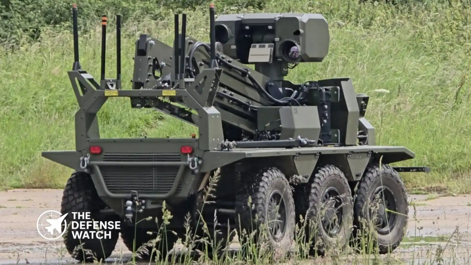
British defense technology company Roke is advancing a navigation capability designed to help unmanned ground vehicles maintain accurate positioning when GPS signals are unavailable, jammed, or spoofed. The Roke Exploration Navigation System (RENS) combines inertial navigation, computer vision, and sensor fusion to provide autonomous navigation in tunnels, buildings, underground facilities, and contested battlefields where satellite-based positioning cannot be relied upon.

(adsbygoogle = window.adsbygoogle || []).push({});

RENS Targets A Critical Military Vulnerability

The Roke Exploration Navigation System (RENS) is emerging as a notable British contribution to the growing effort to ensure military platforms can operate effectively in GPS-denied environments. The system is designed to provide resilient positioning, navigation, and timing capability for personnel and unmanned systems without relying on external satellite signals.

Contents
  • RENS Targets A Critical Military Vulnerability
  • How The System Works
  • Why GPS Independence Matters For UGVs
  • Strategic Importance In Electronic Warfare Environments
  • Technical Challenges Remain
  • Growing Demand For Alternative Navigation Systems

The capability addresses a challenge that has become increasingly prominent in modern warfare. Military operations in Ukraine, the Middle East, and other contested theaters have demonstrated the effectiveness of electronic warfare systems that disrupt Global Navigation Satellite Systems (GNSS) through jamming and spoofing attacks. These threats can degrade the performance of drones, autonomous vehicles, precision weapons, and command-and-control networks.

How The System Works

RENS combines three core technologies:

ComponentFunction
Inertial Measurement Unit (IMU)Measures acceleration, movement, and orientation
Computer Vision SystemTracks environmental features and motion
Sensor Fusion ProcessingCombines multiple data sources to calculate position

Unlike conventional GPS-based navigation systems, RENS continuously estimates position using onboard sensors and visual references. The system requires only a camera, inertial sensors, and a compact processing unit, allowing deployment on soldiers, unmanned ground vehicles (UGVs), and other autonomous platforms.

- Advertisement -

Roke states that the technology can provide navigation updates at 10 Hz while maintaining average drift rates of approximately 2.4% in tunnel environments and less than 4% over distances up to two kilometers during extended operations.

(adsbygoogle = window.adsbygoogle || []).push({});

The system can function inside buildings, tunnels, underground complexes, and urban environments where satellite visibility is limited or nonexistent. It also operates without requiring preloaded maps of the operating area.

Why GPS Independence Matters For UGVs

Unmanned ground vehicles are becoming increasingly important across reconnaissance, logistics, route clearance, and combat support missions. However, many autonomous and semi-autonomous systems remain heavily dependent on satellite navigation.

When GPS signals are denied, conventional autonomous navigation systems often experience degraded performance, reduced mission effectiveness, or complete loss of navigation capability. Research into alternative navigation methods has therefore become a major focus for defense organizations worldwide.

For UGV operators, the challenge is particularly acute because ground vehicles frequently operate in environments where satellite reception is naturally obstructed, including:

  • Urban canyons
  • Underground facilities
  • Tunnels
  • Industrial complexes
  • Dense forests
  • Indoor structures

RENS is designed specifically for these conditions, enabling continuous navigation even when external positioning signals are unavailable.

Strategic Importance In Electronic Warfare Environments

The operational significance of GPS-independent navigation extends beyond unmanned vehicles.

Modern military doctrine increasingly assumes that satellite navigation will be contested during high-intensity conflict. Russia, China, Iran, and several other nations have invested heavily in electronic warfare capabilities capable of disrupting GNSS services across wide areas.

- Advertisement -

As a result, resilient Positioning, Navigation and Timing (PNT) technologies have become a priority area for NATO militaries. Roke’s broader Resilient Precision Navigation and Timing portfolio reflects this trend, focusing on technologies that allow military forces to continue operating despite satellite disruption.

From a U.S. and allied defense perspective, systems such as RENS offer several operational advantages:

  • Reduced dependence on vulnerable space-based infrastructure
  • Greater autonomy for robotic systems
  • Improved survivability in contested electromagnetic environments
  • Enhanced situational awareness for dismounted troops and vehicles
  • Increased effectiveness during underground and urban operations

These advantages are particularly relevant as NATO forces prepare for potential conflicts involving sophisticated electronic warfare threats.

Technical Challenges Remain

Despite significant progress, GPS-independent navigation remains a technically demanding field.

Traditional inertial navigation systems suffer from cumulative error, commonly known as drift, which increases over time without external corrections. Modern approaches seek to mitigate this limitation by combining inertial sensors with computer vision, machine learning, and environmental feature recognition.

RENS appears to follow this approach by using visual cues to continuously correct inertial measurements and maintain more accurate position estimates. The result is a navigation architecture that can operate autonomously while reducing the long-term accuracy degradation associated with purely inertial systems.

The broader defense sector is pursuing similar efforts across air, land, maritime, and space domains, reflecting a growing consensus that future military operations cannot depend exclusively on GPS.

Growing Demand For Alternative Navigation Systems

The development of RENS highlights a wider shift occurring across Western defense programs. As electronic warfare threats become more sophisticated, militaries are investing in alternative navigation architectures that combine inertial sensing, computer vision, signals of opportunity, and advanced sensor fusion.

For unmanned ground vehicles in particular, reliable navigation in denied environments is increasingly viewed as a prerequisite for future autonomous operations.

By enabling navigation without satellites, RENS demonstrates how next-generation positioning technologies could help maintain battlefield mobility, situational awareness, and mission effectiveness when traditional navigation systems are degraded or unavailable.

TAGGED:GPS-Denied Navigationunmanned ground vehicles
Share This Article
Facebook Copy Link Print
ByDaniel Mercer / Defense & Aerospace Analyst
Follow:
Daniel Mercer is a defense and aerospace analyst at TheDefenseWatch.com covering military aviation, aerospace technology, unmanned systems, air warfare, and defense procurement. His reporting uses official documents, government and military statements, company announcements, and other public sources.
Leave a Comment

Leave a Reply Cancel reply

Your email address will not be published. Required fields are marked *

Latest Defense Systems

  • RUTA B1 Cruise Missile RUTA B1 Cruise Missile
  • XQ-67A Drone XQ-67A Drone
  • B-25 Mitchell Bomber B-25 Mitchell Bomber
  • F-100 Super Sabre F-100 Super Sabre
  • North American F-86 Sabre North American F-86 Sabre
  • North American XB-70 Valkyrie North American XB-70 Valkyrie
  • Northrop YF-23 Fighter Northrop YF-23 Fighter
  • P-51 Mustang Fighter Aircraft P-51 Mustang Fighter Aircraft
  • Rafale F5 Fighter Rafale F5 Fighter

Recent Compares

  • J-10C vs JF-17 Thunder: Which Fighter Is More Capable? J-10C vs JF-17 Thunder: Which Fighter Is More Capable? View Comparison →
  • Tejas vs Gripen: Key Differences and Capabilities Tejas vs Gripen: Key Differences and Capabilities View Comparison →
  • Tejas vs MiG-21 Bison: How India Replaced Its Iconic Supersonic Fighter Tejas vs MiG-21 Bison: How India Replaced Its Iconic Supersonic Fighter View Comparison →
  • F-35 vs F-16: Stealth, Sensors and Combat Roles F-35 vs F-16: Stealth, Sensors and Combat Roles View Comparison →
  • Tejas Fighter Jet vs F-16 Fighting Falcon: Capability Compared Tejas Fighter Jet vs F-16 Fighting Falcon: Capability Compared View Comparison →
  • Rafale Fighter Jet vs F-16 Fighting Falcon : Which Fighter Has the Edge? Rafale Fighter Jet vs F-16 Fighting Falcon : Which Fighter Has the Edge? View Comparison →
  • Su-57 Fighter Jet vs J-20 Fighter Jet: Stealth and Air Combat Compared Su-57 Fighter Jet vs J-20 Fighter Jet: Stealth and Air Combat Compared View Comparison →
  • Mirage 2000 vs Tejas Mk1A: Legacy Combat Power vs Indigenous Modernization Mirage 2000 vs Tejas Mk1A: Legacy Combat Power vs Indigenous Modernization View Comparison →
  • Rafale Fighter Jet vs F-22 Raptor: Which Air Dominance Fighter Has the Edge? Rafale Fighter Jet vs F-22 Raptor: Which Air Dominance Fighter Has the Edge? View Comparison →
  • Tejas Fighter Jet vs. Rafale Fighter Jet: India’s Indigenous Fighter Meets France’s Proven Multirole Combat Aircraft Tejas Fighter Jet vs. Rafale Fighter Jet: India’s Indigenous Fighter Meets France’s Proven Multirole Combat Aircraft View Comparison →

Recent Posts

  • U.S. Plans Resilient Military Bases With Independent Power and Water Systems
  • China Addresses Report on New Nuclear Submarine Missile Test
  • Destinus Produces 1,750 Ruta B1 Cruise Missiles as European Output Expands
  • Boeing Wins $11.1 Million Contract Modification for Kuwait F/A-18 Training Support
  • U.S. Navy Awards $23.1 Million Contract for Cybersecurity of Shipboard Power Systems

You Might Also Like

UK Digital Targeting Web minimum viable product
Cyber & Space Defense

UK to Field First Elements of Digital Targeting Web in 2026, MoD Confirms

September 9, 2026
China space station debris damage
Cyber & Space DefenseSpace Assets & Satellites

Space Debris Damages Chinese Spacecraft, Highlighting Growing Orbital Threat

November 17, 2025
GenAI.mil AI adoption
AI & Electronic WarfareCyber & Space Defense

Government AI Models Advance as GenAI.mil Expands Across War Department

October 1, 2026
U.S. Space Academy
Cyber & Space DefenseSpace Assets & Satellites

U.S. Space Academy Commission Begins Work As Washington Targets Next-Generation Space Workforce

September 11, 2026

Logo

Copyright © 2026 TheDefenseWatch.com

Helpful Links

  • Home
  • About Us
  • Privacy Policy
  • Terms of Use / Disclaimer
  • U.S. Privacy Notice – CCPA Compliance

Defense Systems

  • Defense Systems
  • Comparisons 
  • Manufacturer
  • Tactical Calculators

Popuplar

Which 5 Air Forces Possess the Costliest Fighter Jet Fleets in the World
Evolving Strategic Value: Carrier Strike Groups in the Indo-Pacific’s Future Security Architecture
Autonomous Weapon Systems Spark U.S. Ethics Debate Amid Rapid Military AI Integration

We report on developments involving military forces, governments, defense companies, research organizations, and security institutions around the world. 

Welcome Back!

Sign in to your account

Username or Email Address
Password

Lost your password?